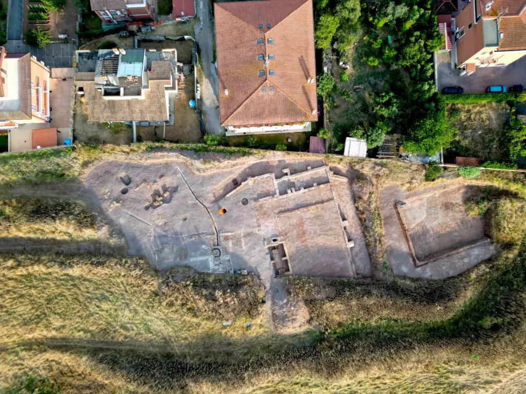
Site:Castel di Leva, Rome
Project:3D survey
Date:2025
Client(s):Archeo di F. Turchetta
Theintegrated 3D survey of the archaeological site of Castel di Leva, located on the southern outskirts of Rome, represents an example of how digital documentation technologies can support archaeological research and excavation monitoring. The site, covering an area of more than3,000 square meters, was discovered during construction works in a developing urban area and subsequently investigated through archaeological excavation.
The excavation revealed a complex archaeological context that included both surface structures and a series ofsubterranean spaces, likely part of a system ofcisterns and water management channels. Documenting such a complex environment required a methodological approach capable of capturing both the large-scale spatial organisation of the site and the fine details of architectural and stratigraphic features.
To achieve this, the3D documentation of the site was designed as an integrated survey workflow, combining multiple recording technologies includingdrone photogrammetry, terrestrial photogrammetry, and terrestrial laser scanning.
Drone Photogrammetry for Large-Scale Documentation
The first stage of the survey focused onaerial photogrammetry using a drone, which allowed efficient coverage of the entire excavation area and provided a consistent spatial framework for the documentation process.
Several drone-based acquisitions were carried out during different phases of the excavation in order to record the evolving stratigraphic context. The surveys were conducted using aDJI Mini 3 Pro, a lightweight drone that offers an effective balance betweenphotogrammetric image quality and operational flexibility, particularly in inhabited or urban environments where flight restrictions and logistical constraints must be considered.
The aerial survey was supported by a network ofGround Control Points (GCPs), which allowed accurate georeferencing of the photogrammetric models. These datasets made it possible to generate high-resolutionorthomosaics and digital surface models, providing archaeologists with detailed visual documentation of the excavation and supporting the production of standard 2D outputs used in archaeological recording.
Terrestrial Photogrammetry for High-Resolution Detail
While drone photogrammetry provided comprehensive coverage of the site, additionalterrestrial photogrammetric surveyswere carried out to capture higher levels of detail in specific areas of interest.
These acquisitions were performed using aCanon R8 full-frame mirrorless camera equipped with a 24 mm lens, allowing the capture of high-resolution imagery suitable for precise 3D reconstruction of architectural elements, stratigraphic features, and excavation surfaces.
Terrestrial photogrammetry is particularly effective for recording vertical surfaces, structural remains, and complex textures that may not be fully captured by aerial datasets. Integrating both aerial and ground-based photogrammetry therefore ensured a more complete and detailed representation of the archaeological context.
Terrestrial Laser Scanning of the Hypogeal Structures
One of the most challenging aspects of the survey was the documentation of thehypogeal environments uncovered during excavation. These underground spaces, characterised by narrow passages and limited natural lighting, required a different recording approach.
To document these areas, aFaro Focus S70 terrestrial laser scannerwas employed. Laser scanning allowed the rapid acquisition ofhigh-density point clouds, capturing the geometry of the subterranean chambers with high precision even in dark or confined conditions.
The resulting datasets provided accurate spatial information about the morphology of the underground structures and their relationship with the surrounding archaeological context.
Integrated 3D Dataset and Processing
The different datasets produced during the survey—including drone photogrammetry, terrestrial photogrammetry, and laser scanning—were processed asseparate componentsand subsequently aligned within a unified digital environment.
The processing and integration of the datasets were performed inRealityScan, where the various components were aligned and merged to produce asingle integrated 3D model of the entire archaeological area.
This integrated model provides a comprehensive digital representation of the site, combining large-scale spatial documentation with detailed recording of architectural and stratigraphic features. Such datasets can support archaeological interpretation, excavation analysis, and long-term documentation of the site.
Digital Documentation in Contemporary Archaeology
Projects such as the3D survey of the Castel di Leva archaeological areademonstrate how integrated digital recording workflows are becoming increasingly central to contemporary archaeological practice. By combiningdrone photogrammetry, terrestrial photogrammetry, and laser scanning, it is possible to document complex archaeological landscapes with a level of precision and completeness that was difficult to achieve using traditional methods alone.
The resulting 3D models not only serve as an accurate record of the excavation but also provide valuable resources for analysis, visualisation, and long-term heritage documentation. As digital technologies continue to evolve, integrated survey approaches like this one are playing an increasingly important role in thedocumentation and interpretation of archaeological sites.